
Annual Ports & Marine Intelligence Program™
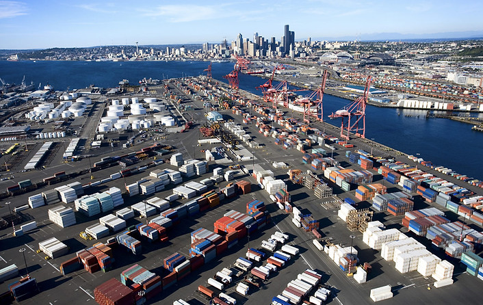

Helping ports, marine terminals, shipping operators, harbour authorities, waterfront developers, and marine infrastructure owners improve operational efficiency, enhance safety, protect critical assets, and optimize maintenance through AI-powered aerial intelligence.
Industry Challenges
Port and marine infrastructure faces constant exposure to saltwater corrosion, wave action, and heavy load cycles, while traditional inspection of quay walls, cranes, and vessel-adjacent structures typically requires scaffolding, rope access, or full operational shutdowns. Undetected deterioration in seawalls and piers is expensive to fix later, professional repair alone runs $100 to $1,200 per linear foot depending on method, before accounting for the operational disruption of a failure.
CropCopters transforms port infrastructure monitoring into a proactive, data-driven intelligence program that inspects cranes, piers, and waterfront structures without scaffolding, rope access, or shutting down operations.
The CropCopters Solution
Our Annual Ports & Marine Intelligence Program™ combines the DJI Matrice 400 RTK platform, Zenmuse L3 long-range LiDAR, and Zenmuse H30T thermal and RGB sensors with AI-assisted analytics and DJI Terra processing to give port operators a complete, recurring picture of waterfront asset condition, planned around vessel movements and weather windows to avoid disrupting daily operations.
Whether managing container terminals, harbour authorities, marine industrial facilities, or waterfront developments, CropCopters delivers the intelligence needed to protect critical assets and optimize maintenance planning.
Included Intelligence Modules™
Wharf, pier, and shoreline modules are priced by linear meter, the natural unit for these structures. Port Operations and Thermal Asset scale by site area. Crane & Equipment Intelligence™ scales by unit count, since inspection time tracks the number of cranes, not the ground they sit on.
01
Marine Infrastructure Intelligence™
Starting From: CAD $2,995 (up to 200 linear metres; $1,850 capture + $1,145 AI audit & reporting; $20/m beyond baseline)
Inspect wharves, piers, docks, jetties, breakwaters, and seawalls for deterioration, structural concerns, and maintenance priorities.
03
Crane & Equipment Intelligence™
Starting From: CAD $2,995 (up to 5 cranes; $1,850 capture + $1,145 AI audit & reporting; $500/crane beyond baseline)
Inspect ship-to-shore cranes, gantry cranes, conveyors, and material handling equipment using high-resolution aerial imagery and thermal analytics.
05
LiDAR Intelligence™
Starting From: CAD $3,995 (up to 200 linear metres; $2,450 capture + $1,545 AI audit & reporting; separate Zenmuse L3 deployment; $18/m beyond baseline)
Produce engineering-grade terrain models, infrastructure measurements, and waterfront mapping supporting marine engineering projects.
07
Coastal Infrastructure Intelligence™
Starting From: CAD $2,495 (up to 200 linear metres; $1,550 capture + $945 AI audit & reporting; $14/m beyond baseline)
Monitor shoreline protection systems, erosion, sediment movement, and coastal resilience infrastructure.
09
Emergency Response Intelligence™
Starting From: Custom Enterprise Pricing
Rapid aerial assessment after vessel incidents, storms, flooding, or structural failures surveying multiple berths and infrastructure within minutes without exposing personnel to hazardous conditions.
02
Port Operations Intelligence™
Starting From: CAD $2,495 (up to 10 ha; $1,550 capture + $945 AI audit & reporting; $180/ha beyond baseline)
Monitor operational areas, cargo yards, logistics infrastructure, and traffic flow to improve operational efficiency and planning.
04
Thermal Asset Intelligence™
Starting From: CAD $2,995 (up to 10 ha; $1,850 capture + $1,145 AI audit & reporting)
Detect overheating electrical systems, mechanical equipment, motors, and transformers before failures impact operations.
06
Digital Twin Intelligence™
Starting From: CAD $4,995 per facility ($3,000 LiDAR capture + $1,995 AI-assisted model generation)
Develop Digital Twins of ports and terminals to support engineering, maintenance planning, expansion projects, and remote inspection.
08
Asset Health Intelligence™
Starting From: CAD $2,995
Deliver AI-assisted Asset Health Scores™ that support maintenance prioritization and budgeting across your port facility.
10
Marine Documentation Intelligence™
Starting From: CAD $1,495
Capture high-resolution documentation for engineering records, insurance claims, project progress, and stakeholder reporting.
Recommended Annual Program Packages
Tier pricing below is based on a 200-metre reference facility with 5 cranes on 10 hectares. Larger facilities scale using the per-metre, per-hectare, and per-crane rates above.


